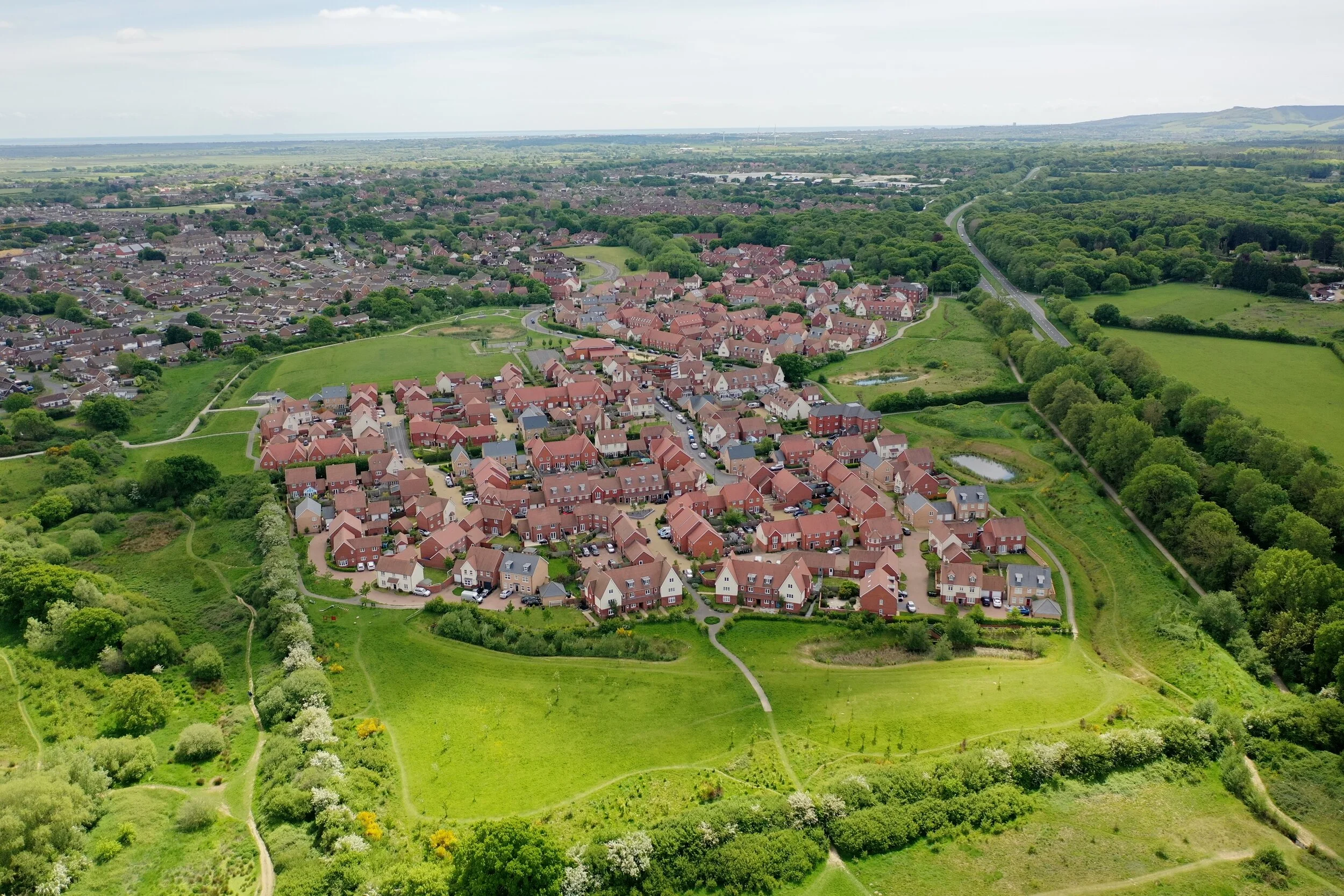
2D and 3D Orthomosaic site mapping services delivered safely by fully insured CAA certified pilots.
Orthomosaic site mapping is a powerful mapping technique that involves capturing aerial images of a site and using specialist software, stitching them together to create a high-resolution, accurate map of the area. This type of mapping allows for precise measurements and detailed analysis of the site, making it ideal for a wide range of applications, from construction and infrastructure planning to environmental monitoring and surveying. Orthomosaic site mapping can provide key insights into a site's terrain, vegetation, and structures, enabling businesses and organizations to make informed decisions about their operations.
orthomosaic site mapping
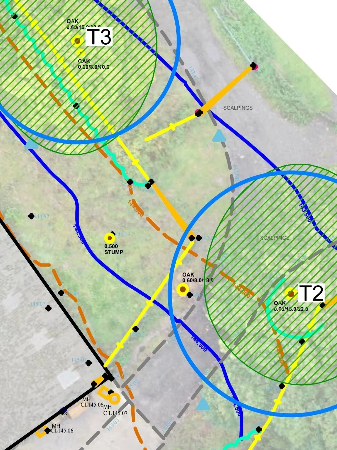
We provide detailed 2D and 3D models of sites to augment your BS5837:2012 tree survey assessments. Our HD imagery can be used in CAD or GIS software, and we offer a range of mapping options to suit your needs. Our aerial imagery is particularly useful for planning, estate management, canopy assessments, and more.
By overlaying your proposal against up-to-date high definition aerial imagery, you can gain a unique perspective on your site and assess potential impacts, aid in logistical planning, and consider arboricultural constraints to construction. Our service also provides logistical insight for construction phasing on larger sites, including mapping and planning vegetation clearance, temporary storage yards, and surfaces. Allowing information to be presented and discussed, providing a clear overview of the project.
We can also convert mapping data for use as base mapping on handheld data capture terminals or for web use in a range of formats. By using our drone mapping services, you can provide a unique selling point for your tree reporting, creating a high-quality service that stands out from the competition. Contact us today to discuss your mapping needs and learn more about how we can help you achieve your goals.
Aerial imaging can add extreme detail to existing topographical surveys and allow visualisation of proposals with a unique level of detail.
Shine a Light on Your Development with 3D Shadow Modelling
Rapidly gain detailed insight into shade constraint.
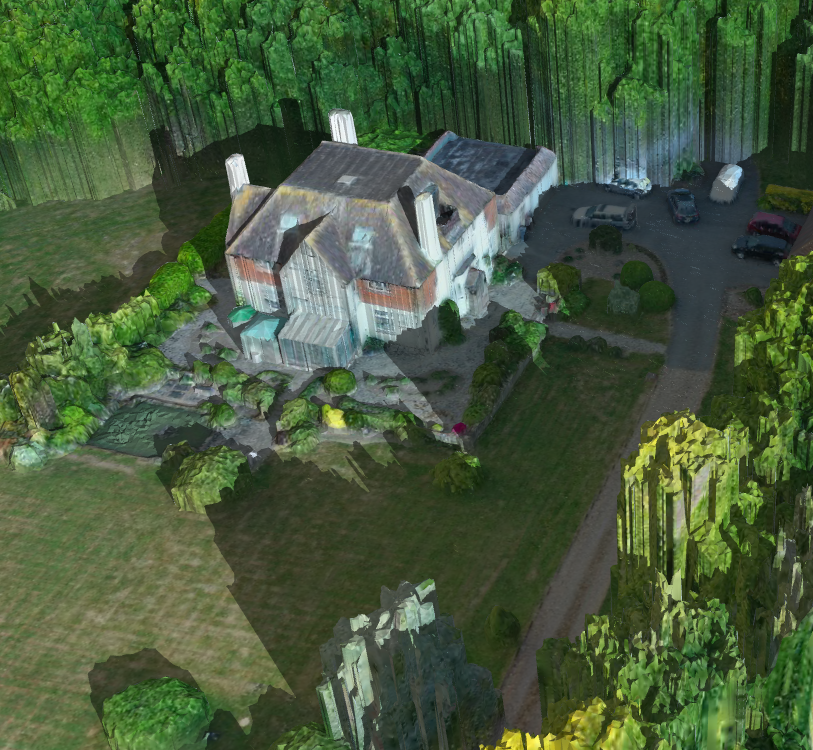
Our 3D shadow modelling service is offered as a standalone service that can augment wider tree assessments at your site. This service provides a highly detailed understanding of tree shadow impact on your scheme, allowing you to maximize available sunlight to your proposed new development or justify unit position in constrained environments. This is done by presenting a detailed 3D shadow modelling assessment alongside your BS5837:2012 tree survey, you can gain valuable insights into the impact of trees on your site.
Our service measures and presents detailed tree and vegetation elevation information for screening consideration, allowing you to make informed decisions about your development projects. Our rapid data capture phase enables us to map large overgrown or inaccessible sites, and our service can be incorporated into the BS5837 tree assessment workflow for maximum results.
Our 3D shadow modelling service allows you to project accurate shadows on a detailed 3D model of your site, as it is at the time of assessment, and carry out follow-up assessments post vegetation clearance to measure change. We also create Digital Elevation Models (DEM) illustrating tree height variation across plots to identify key screening trees and areas where screening may need bolstering.
Our HD aerial imagery is available in many formats, including JPEG, PNG, PDF, DWG, SHP, GeoTIFF, and more, providing valuable data that can be utilized in other aspects of your design workflow. Contact us today to learn more about how our 3D shadow modelling service can augment your wider tree assessment and benefit your development projects.
Elevate Your Ecological Consultancy with High-Quality UAV Imaging Services
Acting as a subcontractor, our UAV imaging service offers valuable data collection and analysis to ecological consultants. Our drone technology provides high-quality aerial imagery, allowing for detailed site mapping and analysis. Our experienced professionals can work alongside ecological consultants to provide accurate and reliable data for a wide range of projects, from habitat mapping to biodiversity assessments. Our UAV imaging service is a cost-effective and efficient solution, enabling consultants to gather data quickly and safely, without the need for expensive and time-consuming manual surveys. Contact us today to learn more about how our UAV imaging service can benefit your ecological consultancy projects.
Carry out assessments of large or inaccessible sites far faster with an otherwise unobtainable level of detail. Get in touch to discuss how utilising drone services can add value and dimension to your projects.
Insurance provided by Cover Drone


